Getting Started
Maps
Your Account
Adding Data
Start Your Property Survey with Site Control Pro
Introduction
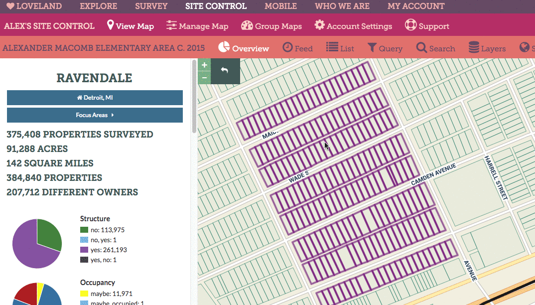
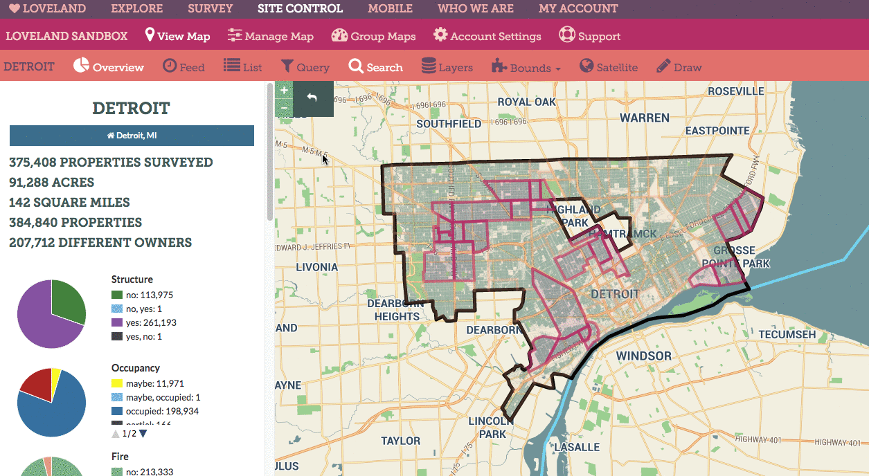
Pro and Enterprise Site Control users can create custom surveys and go into their cities and neighborhoods equipped with the LOVELAND App to take pictures and answer questions about property. The data and photography collected is attached to the parcels surveyed and saved privately in your Site Control account where you can use it to build maps and make decisions supported by the latest information collected on the ground.
Here’s how to get started with your very own property survey:
Step 1:
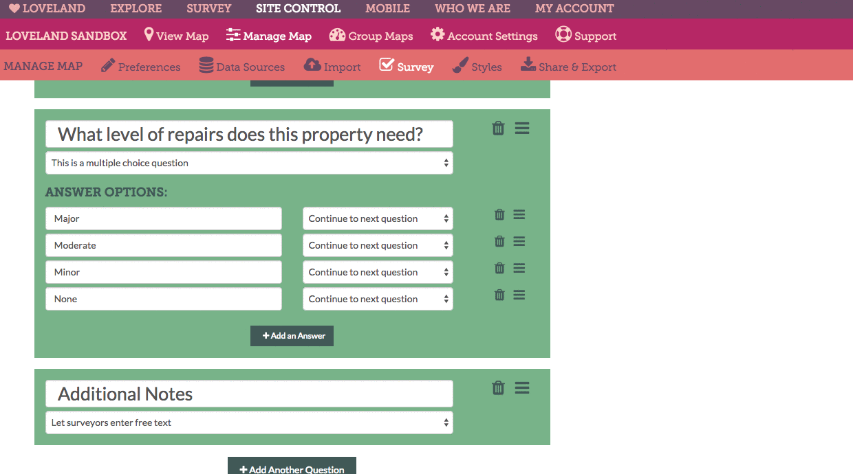
Navigate to the survey creation page in your Site Control account and start building your survey questions:
Step 2:
When you’re finished setting up your survey, be sure to click “Save Survey”:
Step 3:
If you haven’t already, now’s the time to download the LOVELAND App. The LOVELAND App is available for iOS and Android devices:
Step 4:
When you’re ready to start surveying property, open up the LOVELAND App on your smartphone and login using your Site Control credentials.
Step 5:
Tap the Survey menu icon to pull up a list of surveys available to your Site Control account. By default, all accounts can contribute to the public “Great American Parcel Survey.” Your private Site Control surveys will appear beneath, titled with the name of your map.
Step 6:
To survey a property, tap the outline of the parcel you want to survey. The parcel you’ve selected will shade in blue, and its address and Google Street View image will appear at the bottom of the device’s screen. When you’re ready to survey, tap the camera icon.
Step 7:
Answer your survey questions by tapping the appropriate option for the property you’re surveying.
Step 8:
When you’ve reached the end of your survey questions, you’ll see two buttons: “Submit Blext” or “Add Another Photo”. If you’d like to add additional photos, tap Add Another Photo to keep taking pictures. When you’re ready to send your survey and its data and photography to Site Control, tap “Submit Blext”.
Step 9:
Back in your Site Control account, you can navigate in the map to the region you were surveying and click any highlighted parcel (denoting properties you’ve surveyed) to see the imagery and data. Or, you can click the “Feed” icon to see a stream of all the information you’ve collected in the map.